Comments enabled by Jason Turgeon

By request, I’ve found a way to allow commenting on posts.  This isn’t something that is built in to Tumblr.  The service is called Disqus, and you should be able to login with your facebook, twitter, or google account.  If not, I’d encourage you to use your real name to help us keep discourse on the site civil.

If it’s not immediately evident, all you have to do to comment is click the text that says something like “0 comments and 0 reactions” under any post to enlarge the comment field.

Louis Prang by Jason Turgeon

Louis Prang, whose name lives on in the Prang House on the corner of Centre and Gardner, was one of the celebrities of our neighborhood in its industrial heyday.  I’d been meaning to write a full post on Prang and his printing company, but Mark over at And This Is Good Old Boston beat me to it.  

The short version: Mr. Prang published the first Christmas card in the US right here in our neighborhood, and lived in his luxurious estate right behind the factory.  Go read the full version at this link, and if I can find more info to add to it I’ll update this later.

1977 pamphlet by Roxbury Action Program by Jason Turgeon

Jim Raynor, whose family has been here for 45 years, sent me this wonderful 1977 pamphlet from the Roxbury Action Program.  Jim’s mother Patricia was one of the founders of the RAP.  It’s a great glimpse into our more recent history and also contains some of the more familiar stories written from a different perspective from most of the other pieces I’ve linked to so far.  It’s also good to get more info about the RAP itself.  The organization is well-known from its former headquarters in the Kittredge House but I didn’t know anything about the specifics of the work the program did.

Download the 5.4 MB PDF scan of the pamphlet from this link.

Among the new info I picked up here was the fact that so many of the early residents of our neighborhood, with names like Ruggles, Weld, Gore, and Seaver that live on in our streets, were slave owners.  Our neighborhood’s relationship with slavery is more well-known through the later work of William Lloyd Garrison than through slave-owners, but I suppose in the 1740s there was nowhere in the colonies where slavery was not felt in some form.  

It was also good to see pictures of the old housing stock and the activists who started its resurgence.  I know our neighborhood - like so many other urban areas across the country - had fallen on hard times by the late 1960s, but this is one of the first specific descriptions of what the neighborhood looked like in those days.

Perhaps my favorite part of this document as an armchair historian is the proposed Highland Park Historical Pathway from Eliot Square to the High Fort, discussed briefly on page 23 of the pamphlet.  Although there aren’t many details, the concept of a series of self-guided walking tours explaining the history of our neighborhood sells itself. I’d love to see this idea picked up and brought to fruition.

As an aside, copyright regulations prevent much material from this vintage from making it onto the internet.  Anything after 1923 is pretty much off-limits thanks to the continual lobbying efforts of our corporate overlords at Disney and in other big media industries.  So it’s very hard for me to find this kind of material online.  If you have something you are willing to share and, like this, I can be reasonably assured that I won’t get sued for posting the copyrighted material, please send it along.  I’d love to have more info on this site about the more recent history of our neighborhood.

by Jason Turgeon

According to the caption from the BPL on flickr, the “old Guild house” in this picture sat on the corner of Bartlett and Washington.  The photo is labeled “elevated railroad corner shops there now,” so it presumably isn&#8217…

According to the caption from the BPL on flickr, the “old Guild house” in this picture sat on the corner of Bartlett and Washington.  The photo is labeled “elevated railroad corner shops there now,” so it presumably isn’t the corner of Bartlett and Washington where the Bartlett Bus Yard currently sits abandoned.  My best guess is that this is now the site of the ancient Cadillac repair place across the street from the new police station.

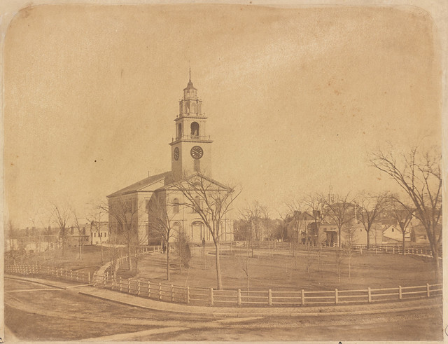
History of the First Church of Roxbury, 1630-1904 by Jason Turgeon

One of the nice things about digging into the history of Roxbury in the age of Google is that our history is both incredibly well-documented and now searchable.  A search on the history of the Thwing Estate, which lives on in the name of Thwing Street, led me to this gem of a book, written by Walter Eliot Thwing. Here’s a link to the book on Google Books.

I’ll write my post about the Thwings later.  For now, enjoy this book, which goes back to the earliest days of Roxbury, when Brookline was still called “Muddy River” and people-mostly farmers, we can presume- from West Roxbury, JP, Brookline, and all of Roxbury made the trek every Sunday to worship.  

It wasn’t until 1712, more than 80 years after the First Church was founded, that West Roxbury got a church of its own, another 5 years until Brookline had one, and over 50 more years (1770) before Jamaica Plain had enough of a population to support a church.  It wasn’t until 1821, nearly 200 years after the First Church was founded, that Roxbury got its second church, in Dudley Square.  It’s hard to believe now, when there are perhaps a half a dozen or more churches in our tiny neighborhood, that this church was such an important part of life for so much of greater Boston.

The First Church, it’s worth noting, was founded by members of the “first company of 1630,” including John Eliot (of Eliot Square) and William Pinchon (of Pynchon Street, long renamed Columbus Ave), and at the time of its founding in 1630 our town was known as Roxborough.  The Puritans of Roxborough wanted a congregation of their own so that they wouldn’t have to walk miles through forest paths to the other church service in Dorchester.

And lest we forget what the Puritans were all about, consider this sentence:  ”On the Rockesbrough Hill fast by the first little rough meeting-house stood the stocks and the pillory, guardians of peace and terror to evil doers, where the offender had to stand in full view of the elect, and where every offence against the gospel was sure to be followed by the penalty of the law.”

Happy reading!

The Dennison Tag Factory by Jason Turgeon

Most of us don’t know much about the large vacant lot between Valentine, Fulda, Thornton, and Vale Streets.  It’s surrounded by a chain link fence and the outer ring of the lot is cleared a couple of times a year, but inside is something of an urban wildlife sanctuary with mature trees and dense undergrowth.  

Today

1895

1873

Before it was a home for wild turkeys and skunks, this lot used to be a thriving manufacturing facility for the Dennison company.  Dennison, founded by brothers Aaron and EW Dennison as an adjunct to their father’s jewelry business, was originally a jewelry-box making company run out of the family home in Brunswick, Maine, in the 1840s.  EW, by all accounts an ambitious and enterprising young man, took over the company within a few years and his brother went on to become a leading watchmaker.  

EW soon moved the headquarters to Boston, with a storefront on Milk Street near the current location of Flat Black Coffee and a leased manufacturing facility in Roxbury - the Perkins factory.  In 1878, when Dennison was making boxes, cards to display jewelry, and selling shipping tags with bits of string tied to them by the millions, they bought out their hosts at the Perkins facility and changed the name to the Dennison Manufacturing Company.  

It’s not clear how long Dennison kept the factory open, but it was still there in 1912 when Lewis Hine photographed the child labor practices related to the factory as part of his nationwide crusade to end the then-common practice of child labor.  We are fortunate enough to have many of his images of our neighborhood well-preserved and cataloged at a number of places around the internet.  This link seems to be the easiest to navigate and most comprehensive of the ones I’ve found, but there are many others including a large collection at the Library of Congress (see this link, also).

"A typical sight. Family and neighbors working on tags on door steps of Mrs. McCarthy, 88 Marcella Street, Roxbury, Mass. See Home Work report. Location: Roxbury, Massachusetts."

typical sight. Family and neighbors working on tags on door steps of Mrs. McCarthy88 Marcella 

StreetRoxburyMass. See Home Workreport. Location: RoxburyMassachusetts.

In 1919, the Dennison company put out an incredibly detailed history of the company to commemorate its 75th anniversary.  Thanks to that book, I’m able to share this photo of the factory.  There’s an accompanying page of text.  This link will take you to those pages.

By the 1890s, the company had outgrown its Roxbury factory and wanted to consolidate its operations, so it moved everything from the Roxbury factory, an operation in Maine, and another in New York to Framingham.  By the time the commemorative book was written, the Framingham operation employed over 2600 people on a campus of 16 acres and Framingham eventually became known as “Tag Town.”

If you want to know a bit more about the man behind the company, there’s an excellent short biography at this link.  

As of now, I don’t know what happened to the factory after 1898.  All the reports seem to indicated that all of Dennison’s operations were centralized in Framingham, but Lewis Hine’s 1912 photos indicate otherwise.  I also don’t know much about the Perkins factory (aka the NE Gard factory on the 1873 map) that preceded it, but if I can find out more I will update this.  If anyone knows when the factory was closed and when it was demolished, please pass the info on!

UPDATE 10/30/11: Mark writes in to say that “The brick Dennison plant shown in the 1895 map was there until at least 1931. Regarding the Hine photos: by that time, Dennison still owned the property, but it was a furniture factury. It may have been leased out to another company.”  Thanks, Mark!

History of the Standpipe with Great Pics of Old Pamphlet by Jason Turgeon

Here’s another page from the Highland Park website.  The page has some wonderful old pictures of the standpipe and a scan of a very detailed brochure/newspaper article.  The newspaper writers of yore were kind enough to fully catalog all of the points of interest from the balcony’s educational display, so if we ever get a new balcony we can hopefully recreate those signs in some fashion.

by Jason Turgeon

Via the Highland Park neighborhood website, here’s a wonderful bird’s-eye view of the Boston Highlands in 1888.  Click through to see a version you can zoom in on.

Via the Highland Park neighborhood website, here’s a wonderful bird’s-eye view of the Boston Highlands in 1888.  Click through to see a version you can zoom in on.

Highland Park Neighborhood Website by Jason Turgeon

One of my neighbors runs a similar website with a slightly broader focus.  The site serves as the home page for the Fort Hill Civic Association, Margaret Wright Memorial Garden, and Friends of Highland Park, three of our many local neighborhood groups.  I’ll probably steal some of the historical information from her site to have it all in one place, but you should definitely take a look at this site if you are interested in the hill.

http://www.mindspring.com/~highlandpk/index.html

1832 Map of Roxbury by Jason Turgeon

This gorgeous hand-drawn map of Roxbury from 1832 shows what the town looked like back when Roxbury was still largely a rural town with just a few thousand inhabitants and lots of farmland. 

Find the original on the JP Historical Society website at this link.

The Stony Brook by Jason Turgeon

Many people don’t know it, but there was once a brook running from JP along what is now Columbus Avenue and into the area around Forsyth Street on Northeastern’s campus.  The Stony Brook, commemorated in the Orange Line stop of that name, was the source of water for many of the breweries along Pynchon Street.  It was also the source of much misery in Roxbury and Boston due to its frequent floods.  Over time, it was eventually culverted almost entirely, and now it runs underground in a pipe for the majority of its length.  

There is an excellent history of the Stony Brook in blog form at http://stonybrookinboston.blogspot.com/.  Start with the oldest post and read in reverse order.

There is also a very good view of the Stony Brook in this 1832 map of Roxbury from the JP Historical Society.

Notes for Discover Roxbury's Highland Park Architecture Tour by Jason Turgeon

Discover Roxbury, an organization which does great work educating people about the history and culture in Roxbury, has the notes for their walking tour of the architecture of the Highland Park neighborhood available at this link.  The tour starts at Roxbury Crossing, then covers Elliot Square, Highland Ave, Highland Park, and Centre Street.  It’s a great look at the dozens of historically and architecturally important buildings we have in our little neighborhood.

Mel Lyman and the "Hill People" by Jason Turgeon

You may have heard that there is - or was - a commune on the top of Fort Hill next to the park.  Whether or not the group of people who live in the complex at 60 Beech Glen St still meets that description is hard to say, but they definitely did at one point.  Information about them is a bit hard to find and they are very private, although they do run the Fort Hill construction company, now headquartered in Los Angeles.

The commune was led by a charismatic singer named Mel Lyman.  There’s an entire website dedicated to trying to unravel the mystery that surrounded him.  Many of the links on that site are reprints of old articles from the 1960s and 70s about the “Hill People” who started the commune.  It’s a fascinating, if poorly organized, read about the way life was on Fort Hill in the age of Aquarius.

Read the 1973 nomination for Highland Park to the National Register of Historic Places by Jason Turgeon

You can read the nomination form that the city prepared to get Highland Park onto the National Register of Historic Places in its entirety at archive.org.  It’s a fascinating look at the park in a darker time, when rusty playground equipment poked through weeds and the paint peeled off the standpipe.  

It’s also perhaps the most detailed history of the park and the standpipe I’ve found yet, and since it was prepared by the city office in charge of such things I think it’s probably the most accurate version of things we’re likely to find online.  Enjoy!

by Jason Turgeon

From Universal Hub, here’s a great video taken of a special train ride given to rail buffs shortly before the old elevated orange line was torn down.  The train leaves from Forest Hills and runs north on Washington Street.  The video stops as the train enters the tunnels near Chinatown.

School Documents of the Boston Public Schools: Dillaway School District, For Girls by Jason Turgeon

This dry-sounding document contains fascinating glimpses into what school was like 120 years ago.  

Here’s some history on the Dillaway School on Kenilworth Street.

Dillaway School

DILLAWAY SCHOOL DISTRICT, FOR GIRLS.

The Dillaway School, formerly called the Dudley School, for girls, was established in 1839, and occupied the building on Keuilworth street, afterwards used by the Roxbury High School. In 1846 the school was removed to the building on Bartlett street. It was named the Dillaway School in 1879 in honor of Charles K. Dillaway, of Roxbury, for many years a member of the School Board. The present building, on Kenilworth street, Roxbury, was erected in 1882, is three stories high, and contains twelve rooms and a hall.

The Primary buildings of the district are two.

The building on Bartlett street, built in 1846, and enlarged in 1867, is three stories high, and contains six rooms and a small storeroom.

The building on Thornton street, built in 1817, is two stories high, and contains two school-rooms, both occupied.

There is a Kindergarten in the building on Kenilworth street.

There are twenty-one regular instructors in the district, — one female principal and twelve female instructors for the Grammar, and eight female instructors for the Primary Schools.

Sewing is taught by a special teacher to nine divisions of the Grammar School.

Pupils in the Grammar School, 640; Primary Schools, 396; total for district, 1,036.

Jan 6, 1868: Mayor's address to the newly unified Boston and Roxbury by Jason Turgeon

Google now has searchable, linkable archives of tens of thousands of old newspapers!  On Jan 5, 1868, Boston officially absorbed Roxbury.  Here’s the full text of the inaugural address of Mayor Nathaniel Shurtleff.  Note that he specifically calls out funding water infrastructure for Boston Highlands.  Within two years, the standpipe on Fort Hill was built and providing high service water to the hills of Boston.